KNEC KCSE Geography Paper 1 Question Paper / KCSE 2014
KCSE 2014
Geography Paper 1
SECTION A (25 Marks)
Answer all questions in this section
Name two types of hypabyssal rocks.
2 marks
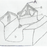
(a) The diagram below shows intrusive volcanic features.
Name the features marked E, F and G. (3 marks)
(b) Name two active volcanoes in Kenya. (2 marks)
5 marks
(a)Give three processes in the hydrological cycle. (3 marks)
(b) State four factors that facilitate deposition in rivers. (4 marks)
7 marks
(a) Explain two reasons why wind is the dominant agent of erosion in arid areas. (4 marks)
(b) Identify two features formed as a result of wind deposition in arid areas. (2 marks)
7 marks
(a) Describe podzoliration as a process of leaching. (2 marks)
(b) State three ways in which mulching helps in soil conservation. (3 marks)
5 marks
SECTION B (75 Marks)
Answer question 6 and any other two questions from this section
Study the map of Migwani 1:50,000 (sheet 151/1) provided and answer the following questions.
(a) (i) Give the longitudinal extent of the area covered by the map. (2 marks)
(ii) What is the magnetic variation of the map? (1 mark)
(iii) Give the six-figure grid reference for the junction of the roads D503 and D507. (2 marks)
(b) (i) Using a vertical scale of 1 cm to represent 100 metres, draw a cross section along the line marked J-K. (4 marks)
(ii) On it, mark and label the following:
• footpath; (1 mark)
• road; (1 mark)
• water pipeline; (1 mark)
• steep slope. (1 mark)
(iii) Calculate the vertical exaggeration of the cross-section. (2 marks)
Citing evidence from the map, give three economic activities carried out in the area covered by the map. (6 marks)
(d) Explain how relief has influenced the distribution of settlement in the area covered by the map. (4 marks)
25 marks
(a) (i) Describe the solar system. (2 marks)
(ii) The local time at Manaul 60°W is 11.30 um. What is the time in Nairobi 37°E? (3 marks)
(b) (i) State five characteristics of the mantle in the interior structure of the earth. (5 marks)
(ii) Outline the evidence which support the theory of continental drift. (4 marks)
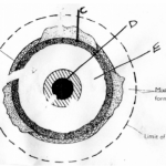
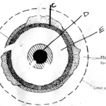
(c) The diagram below represents the revolution of the earth.

(ii) Identify the season represented in the region marked Q. (I mark)
(iii) Describe the climatic conditions in Europe when the Earth is in position R. (3 marks)
(d) With the aid of a well labelled diagram, describe the occurrence of the solar eclipse. (6 marks)
25 marks
The map below shows some climatic regions of Kenya. Use it to answer question (a).

(ii) State three characteristics of the climatic region marked Z. (3 marks)
(b) Explain how each of the following factors influence climate:
(i) Altitude; (4 marks)
(ii) Ocean currents. (4 marks)
(c) What are the negative effects of climate change on physical environment? (6 marks)
(d) Students visited a weather station to study recording of weather elements.
(i)State three qualities in the construction of a Stevenson screen they would have observed during the study. (3 marks)
(ii) Identify three types of data they are likely to have collected during the study. (3 marks)
25 marks
9 (a) (i) Name two types of submerged highland coasts. (2 marks)
(ii) Identify two resultant features of the emerged highland coasts. (2 marks)
(b) State three factors influencing deposition by ocean waves. (3 marks)
(c) With the aid of labelled diagrams describe the formation of the following coastal features:
(i) Fringing reef; (5 marks)
(ii) Spit. (5 marks)
(d) Explain the significance of oceans to human activities. (8 marks)
25 marks
(a) (i) Name two mountains in East Africa which are ice capped. (2 marks)
(ii) Identify three ways in which ice moves. (3 marks)
(b) Describe the formation of the following glacial features:
(i) Hanging valley; (6 marks)
(ii) Pyramidal peak. (6 marks)
(c) You are required to carry out a field study on erosional features in glaciated lowland area.
(i) Give two reasons why you would require a working schedule. (2 marks)
(ii) Name three erosional features you are likely to observe during the field study. (3 marks)
(iii) Give three follow-up activities you would undertake after the field study. (3 marks)
25 marks


