KNEC KCSE Geography Paper 2 – 2014 Nakuru District Mock
2014 Nakuru District Mock
Geography Paper 2
SECTION A (25 Marks)
ANSWER ALL THE QUESTIONS IN THIS SECTION
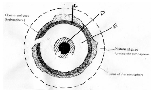
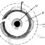
Study the diagram below showing the Internal Structure of the earth and answer question
(a) and (b)
(a) Name the parts marked C and D (2 marks)
(b) State three characteristics of parts marked E (3 marks)
5 marks
Describe the origin of continents according to the theory of Continental Drift.
5 marks
(a) Give three processes that lead to the formation of Lakes. (3 marks)
(b) Apart from Lake Magadi, name two other lakes within the Rift Valley in Kenya
that have high levels of salinity. (2 marks)
5 marks
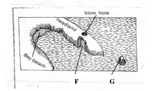
The diagram below shows erosional features of the waves at the coast. Use it to answer question (a)
(a) Identify the features marked F and G. (2 marks)
(b) Give three submerged upland coasts (3 marks)
5 marks
(a) Distinguish between soil profile and soil catena (2 marks)
(b) Give three soil forming processes. (3 marks)
5 marks
SECTION B (75 Marks)
Answer question 6 and any other questions from this section.
Study the map of Karatina (1:50,000) sheet 121/3 provided and answer the following questions.
(a) (i) Give the latitudinal extent of the area covered by the map. (2marks)
(ii) Identify two districts represented in the area covered by the map. (2 marks)
(iii) Convert the ratio scale used in the map to a statement scale. (2marks)
(b)(i) Calculate the bearing of Kiriti school in grid square 9745 from a school in
grid square 9451. (2 marks)
(ii) Measure the distance of an all weather road, bound surface from a junction in
grid square 9247 to a junction at Gatei, grid square (9556) (2 marks)
(c) Draw a rectangle measuring 15cm by 12cm to represent the area covered by the map.
(1 mark)
On it mark and name the following
Karatina town (1mark) Tumutumu forest (1 mark) A hill at Tagwa (1 mark) A papyrus swamp (1 mark)
(d) (i) Describe the distribution of settlement in the area covered by the map. (6marks)
(ii) Citing evidence from the maps, explain the factors favouring coffee farming
in the area covered by the map. (4 marks)
25 marks
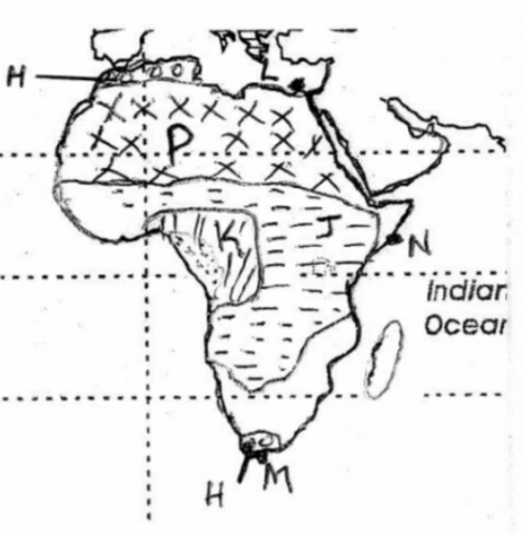
Study the map of Africa provided below and answer questions (a) and (b).
(a)(i) Identify climatic regions marked H, J and K (3 marks)
(ii) Give the names of the towns marked L, M and N. (3 marks)
(b) State five characteristics of climatic region marked P (5 marks)
(c) (i) Give three natural causes of climate change (3 marks)
(ii) State five effects of climatic change (5 marks)
(d) You are supposed to carryout a filed study on weather within your school compound.
Describe how you would use the following instrument during the study.
(i) The Hygrometer (3 marks)
(ii) The rainguage (3 marks)
25 marks
(a)(i) Distinguish between faulting and folding (2 marks)
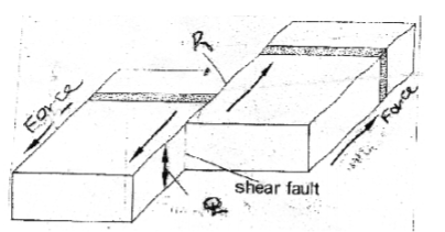
(ii) The following diagram shows a shear fault. Name the parts marked Q and R. (2 marks)
(iii) Apart from shear fault give three more types of faults (3 marks)
(b) Describe how a fault block is formed (4 marks)
(c) Explain four positive effects of faulting (8 marks)
(d) Your class intends to carry out a field study on t he floor of Gregory Rift. Valley
(i) Which three volcanic features would they identify? (3 marks)
(ii) State three problems which they are likely to experience (3 marks)
25 marks
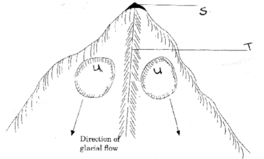
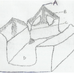
The diagram below show glaciated highlands. Use it to answer question (a) (i)
(i) Name the features marked S,T, and U. (3 marks)
(ii) Give three ice capped mountains in Africa, (3 marks)
(b) (i) Draw a diagram showing a valley glacier. (1 mark)
On it mark and name the position of the following types of moraines. (3 marks) Lateral moraine Medial moraine Terminal moraine
(ii) Using a diagram describe how a crag and tail is formed. (7 marks)
(c) Explain four significance of glaciated landscape to human beings. (8 marks)
25 marks
(a)(i) Give four sources of underground water. (4 marks)
(ii) Which are the three zones of saturation below the earth surface. (3 marks)
(b) State three conditions necessary for the formation of Karst landscape. (3 marks)
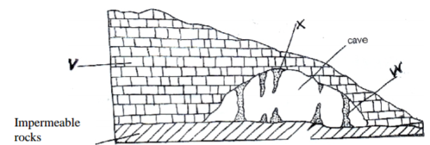
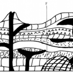
(c) The diagram below shows underground features in a karst area. Use it to answer the
questions (i) and (ii).
(i) Identify the features marked V and W (2 marks)
(ii) Describe how feature marked X is formed (5 marks)
(d) Explain four ways in which karst features influence human activities (8 marks)
25 marks
