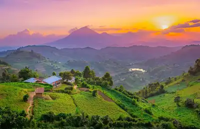
Understanding Uganda: A Detailed Exploration of Its Geographic Boundaries

Uganda, fondly known as the “Pearl of Africa,” is a landlocked country rich in natural beauty and diverse cultures. In this post, we will embark on a journey to understand Uganda’s geographic boundaries, exploring its unique shape, bordering countries, and what makes it such a remarkable place on the African map.
Uganda’s Location and Borders
Uganda is located in East Africa and shares its borders with five neighboring countries:
- Kenya to the east
- South Sudan to the north
- Democratic Republic of Congo to the west
- Rwanda to the southwest
- Tanzania to the south
The total length of Uganda’s borders is approximately 2,698 kilometers (1,676 miles), encompassing a total land area of 241,038 square kilometers (93,065 square miles).
Natural Boundaries
Uganda’s boundaries are not just lines on a map; they are often defined by remarkable natural features:
- The majestic Rwenzori Mountains mark part of the western border.
- Lake Victoria, Africa’s largest lake, shapes the southern boundary.
- The River Nile, one of the world’s most famous rivers, traverses the country.
These natural landmarks don’t just define Uganda’s shape; they are vital to its ecosystem and provide lifelines for many of its citizens.
Uganda’s Regions and Districts
Uganda is divided into four major administrative regions: Central, Western, Eastern, and Northern. These are further subdivided into 135 districts, each with its unique cultural and geographical features.
A Hub of Biodiversity
Uganda’s geographic diversity is mirrored in its rich biodiversity. From the misty mountain gorilla habitats in Bwindi to the sprawling savannahs of Queen Elizabeth National Park, Uganda is home to a myriad of flora and fauna, many of which are unique to the region.
Geopolitical Importance
Uganda’s strategic location in the heart of Africa gives it geopolitical significance. Its borders with key East African nations mean that Uganda plays a vital role in regional politics, economy, and security.
A Country Full of Surprises
Understanding Uganda’s geographic boundaries is more than a study of lines and contours. It’s an exploration of a diverse and dynamic country that bridges cultures, ecosystems, and political landscapes. From its natural borders formed by lakes and mountains to its bustling cities and rural communities, Uganda’s geography tells a story of unity, resilience, and endless potential.
For anyone looking to travel, invest, or simply learn more about this beautiful country, knowing Uganda’s geography is the perfect starting point. The Pearl of Africa awaits your exploration, with its unique boundaries offering an open invitation to discover the beauty within.